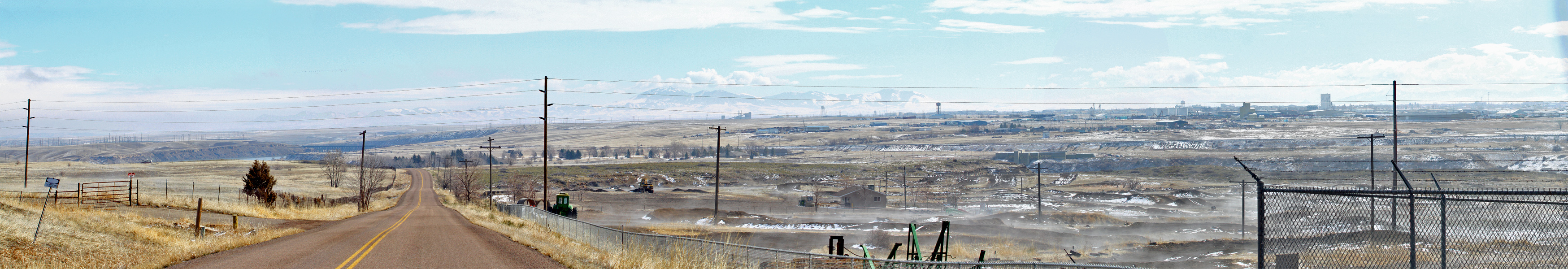
Looking South East from Wiremill (Rainbow Dam?) Road. Â I always knew it as Wiremill, but the signs now say Rainbow Dam Road.
From Left to Right: The back of the Rainbow Dam Power Complex; the BNSF Trestle above Rainbow Dam; straight down the road and across the river is Giant Springs State Park; in the foreground is the steaming Motocross Track; far distant are the Highwood Mountains; in between is Malmstrom AFB, with the coal heating plant and several water towers visible; below the coal plant and tracks is the Montana Fish and Game Building; the Lewis and Clark Interpretive Center seems to balance on top of a power pole; above that the BNSF Tracks stretch across the entire photo; a little to the right and even with the horizon are the giant gas tanks in a tank farm; my house is just this side of the water tower above that; various grain elevators, warehouses and cell towers are to the right of that.
(A six photo panorama: Click to enlarge; BACK to return!)
(1/750s f/8.0 ISO320 70mm +1 stop Canon 7D)
~Curtis in /\/\onTana! {!-{>
Post a Comment